
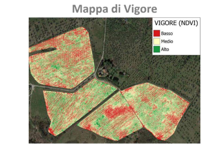
Good Practice on Precision Farming nº10: Prescription maps for variable rate fertilisation using crop vigor maps
Site-specific fertilization using vigor maps is a precision farming technique designed to optimize fertilizer use, enhance agricultural yields, and minimize nutrient losses and environmental impacts. These vigor maps are generated from data collected through sensors...
Good Practice on Precision Farming nº9: Site specific estimation of winter cereals and rapeseed nitrogen needs via satellite
The theoretical calculation of crop nitrogen needs in France has been carried out since 1992. This calculation is used to comply with the Nitrates Directive (European directive). The necessary data are provided by technical institutes and aggregated through COMIFER...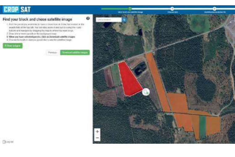
Good Practice on Precision Farming nº8: Cropsat – Free satellite imagery for tailored nitrogen fertilization in wheat
CropSat is a free precision farming tool developed in Sweden that leverages satellite imagery to optimize nitrogen fertilization, particularly for crops like wheat and other cereals. The tool uses Normalized Difference Vegetation Index (NDVI) data from satellite...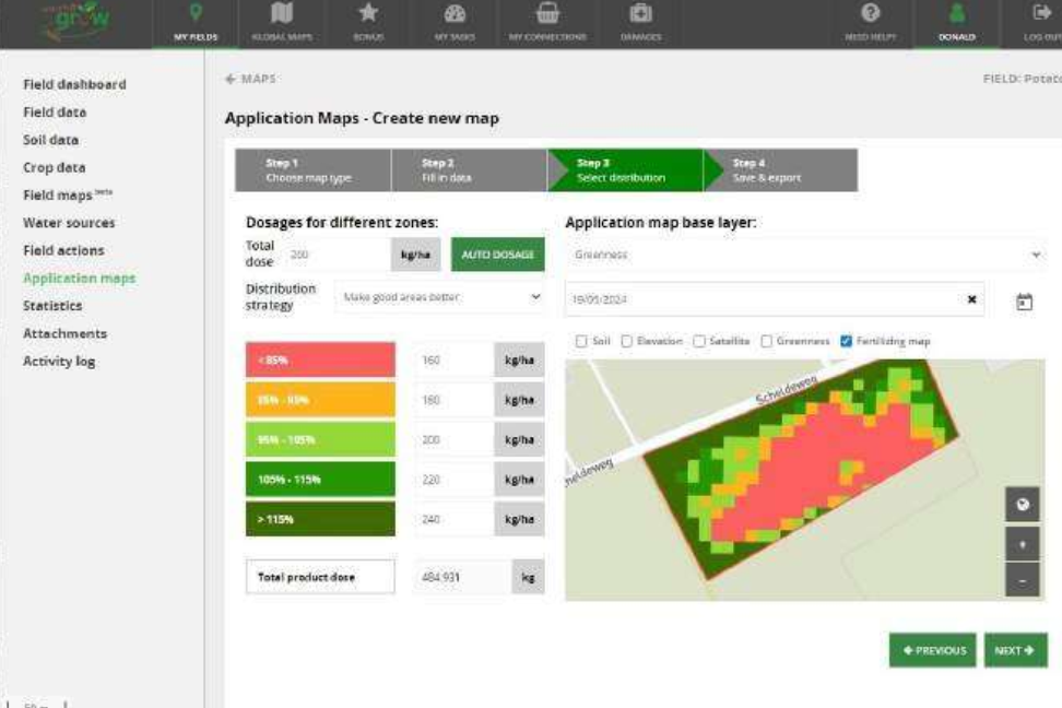
Good Practice on Precision Farming nº7: Use of the online information platform watchitgrow to generate task maps for variable fertiliser applications
WatchITgrow is an online platform to support farmers in monitoring arable crops and vegetables more efficiently in view of increasing yields, both qualitatively and quantitatively. It is a collaboration platform for everyone in the sector, from growers, contractors...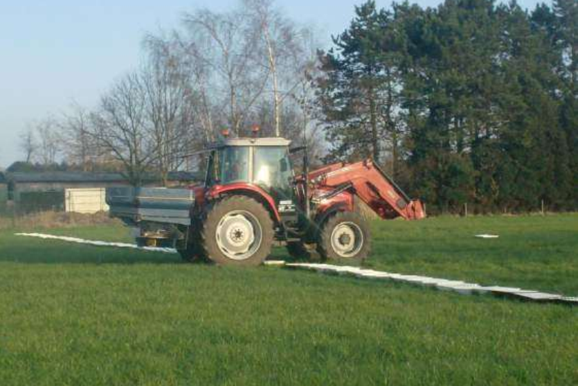
Good Practice on Precision Farming nº6: Fertiliser spread pattern measurement and spreader adjustment using collection trays
Optimizing fertilizer inputs in agricultural production systems is seen as an important strategy to reduce their large environmental impact while supplying the world’s increasing need for food, fibre and fuel. Centrifugal fertilizer spreaders are by far the most used...
Good Practice on Precision Farming nº5: Developing precise fertilisation plans with regard to WRA using satellite imagery and drones in maize and cereals
Satellite images are particularly suited for crops such as cereals, maize, and other field crops, as their scale aligns with the spatial resolution of Sentinel-2 satellite imagery. These images, combined with drone technology, provide essential data for implementing...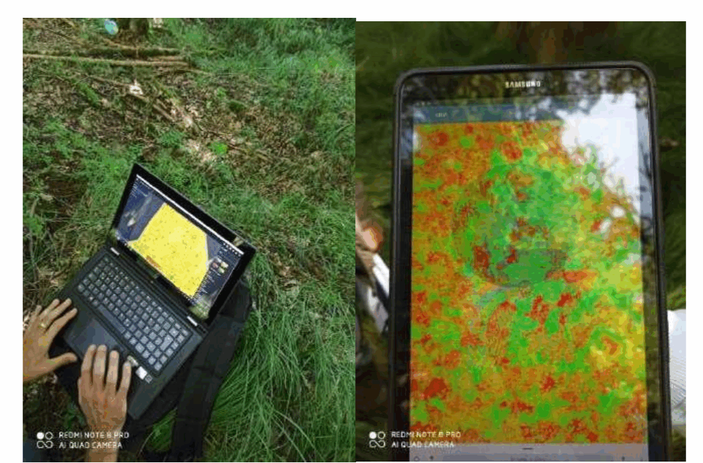
Good Practice on Precision Farming nº4: Use mobile apps and satellite images to identify fertilisation needs
This practice describes the use of available satellite images to monitor actual crop status and act quickly on it. This helps to use fertiliser inputs more efficiently and reduce costs. Variable rate fertiliser prescription maps are traditionally based on soil samples...
Good Practice on Precision Farming nº3: Zero spots method to optimize wheat nitrogen fertilization
The zero spot fertilization method for wheat is based on the following principles: The nitrogen supply to the wheat during the growing season is done in three steps. 1) The first application in early spring at the time of the start of wheat growth (BBCH30 (middle of...